Forward-thinking insights focused on a more sustainable tomorrow.
Shaping the Shoreline: Resilient Solutions to Combat Flooding in the Town of Duck
Ricky Wiatt, PLA, is a vibrant and dynamic landscape architect who emphasizes cultivating relationships and garnering community support by understanding a place through the people that inhabit it. Having grown up along the coast in the heart of the Middle Peninsula of Virginia, Ricky boasts an extensive network of connections throughout the region, making him a familiar and trusted figure to many.
This upbringing instilled in Ricky an understanding of the delicate balance between nature and human development, allowing him to holistically understand sustainable solutions for coastal communities facing sea-level rise. His knowledge extends beyond site design and planting plans to include a keen understanding of coastal resiliency measures vital for safeguarding communities against the impacts of a changing environment.
Ricky served as Project Manager for the recently completed Town of Duck Living Shoreline and Resiliency project in the Outer Banks of North Carolina. In partnership with Chris DeWitt as Client Manager and Principal in Charge, this project embodied a holistic approach, integrating innovative design concepts with resilient infrastructure to maintain viability of North Carolina Highway 12 (NC-12). The Town's approach to resiliency included multi-faceted concepts that communities of any scale can learn from. This is Ricky's story.
Tidal Troubles & Roads Underwater
Many of us along the East Coast, especially in Virginia and North Carolina, are familiar with the Outer Banks of North Carolina. For my family and me, it’s a place that brings us back every season of the year, whether for a beach week, the Duck Jazz Festival, the Outer Banks Home Builders Association Parade of Homes, or to simply enjoy recreational activities, like kayaking on the sound. This connection is why I took pride in contributing to the efforts of the Town of Duck's Living Shoreline and Resiliency project that celebrated its construction completion this May 2024.
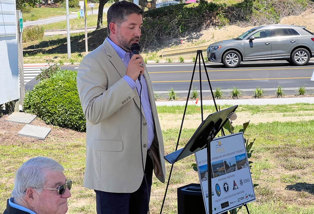
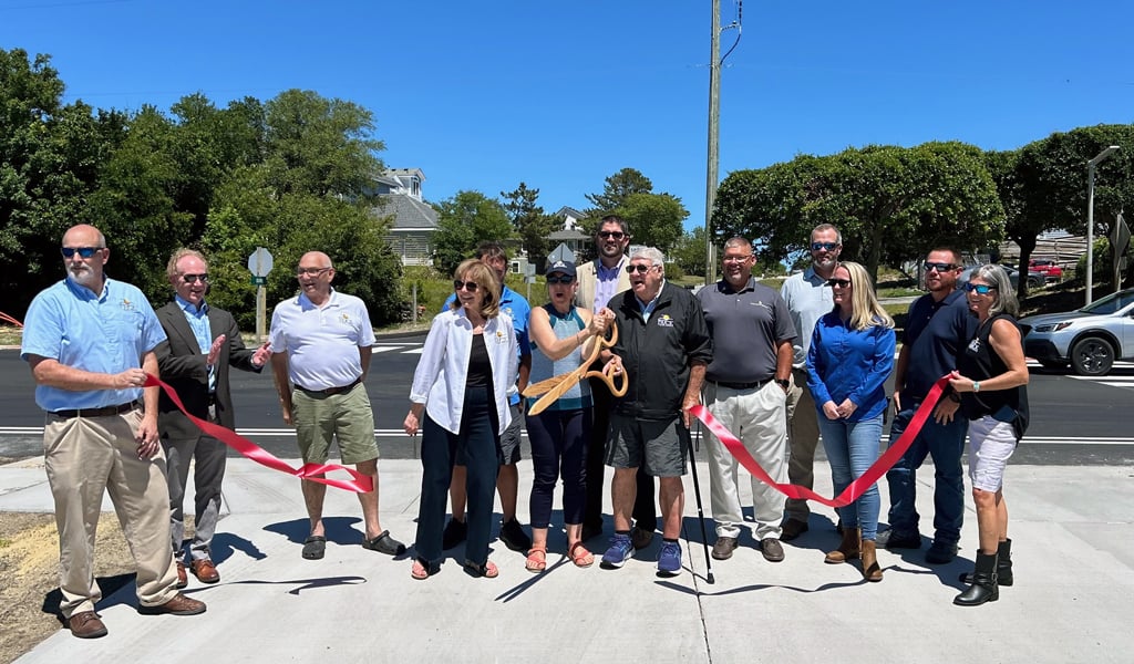
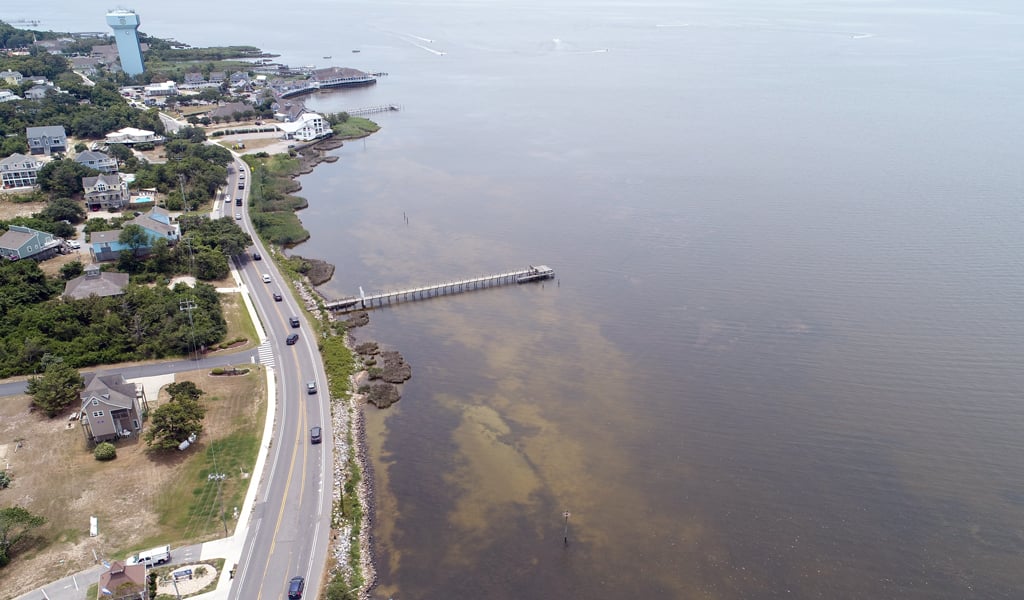
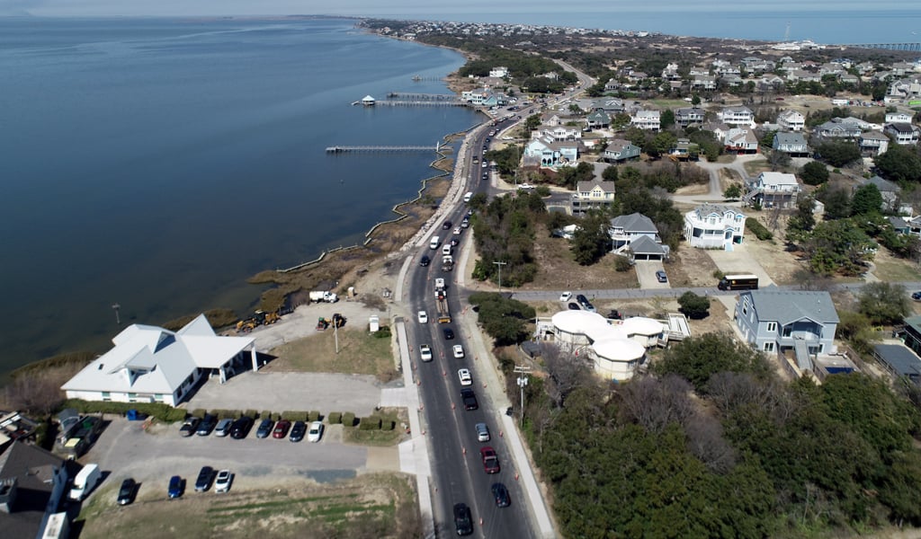
Situated along the northern end of the barrier islands, the Town of Duck is a tranquil location in the Outer Banks, offering a serene haven for beach enthusiasts and a great place to ditch the car to explore by bike or foot. In recent years, the Town found itself grappling with an increasingly urgent problem: the flooding of NC-12, the only north-south connector on this barrier island and a critical thoroughfare connecting to Historic Corolla Village. Due to rising sea levels, major rainfall events, and storm surge, the flooding and shoreline erosion often resulted in road closures, trapping residents and tourists, and creating an obstruction for emergency and storm evacuations. As the Town and stakeholders grappled with this complex interplay of environmental, economic, and social factors, it was clear that the Town needed to step into action to combat this threat, resulting in today's Living Shoreline and Resiliency project.

Shoring Up the Future
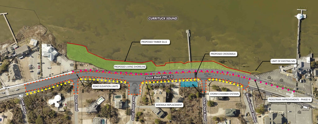
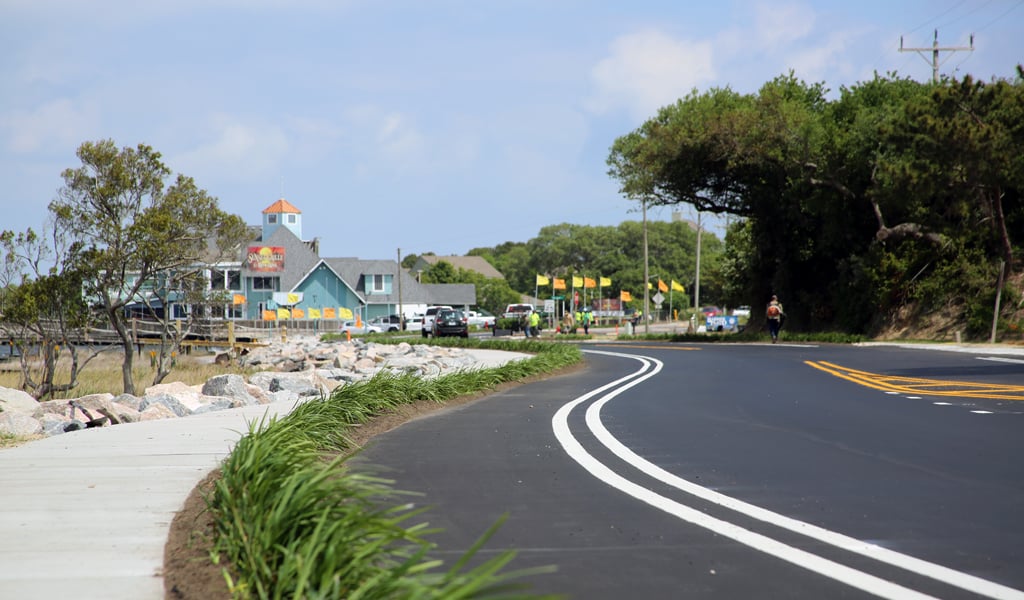
The project site for improvements included a 1,500-linear-foot section of NC-12, a short but critical section of the corridor. This section of roadway was immediately adjacent to the Currituck sound and ranges from two and a half to five feet above sea level.
We knew when approaching this project, we had to develop a holistic and integrated approach to resiliency, where each infrastructure component reinforces the other, to create an adaptable corridor capable of withstanding the uncertainties of a changing climate. For the Town of Duck, we incorporated four concepts:
A new living shoreline
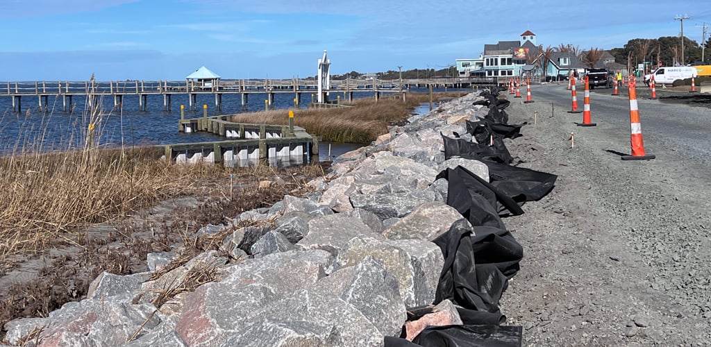
Members of our Coastal Engineering and Resiliency team—Neville Reynolds, Chris Frye, Tim Davis, and Michael Mann—led the engineering and environmental permitting for a nature-based solution that included breakwater sills, marsh protection and restoration, and shoreline stabilization to avoid impacts to submerged aquatic vegetation and to protect and restore wetland habitats.
Elevating the roadway
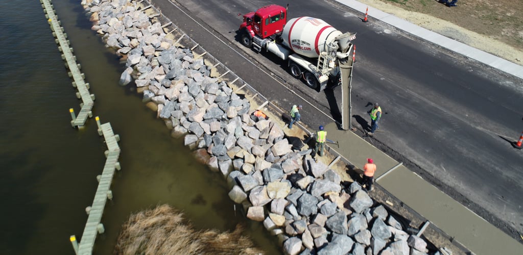
Brandon McAdams led the 1,500-linear-feet of roadway design that was raised to higher elevation above flood levels to make certain the route remained accessible during extreme weather events. The roadway to the north and south of this section sits at higher elevations, which provided logical tie in points.
Drainage improvements
J.D. Hines managed the stormwater improvements that included a storm chamber drainage system to reduce the chance of flooding problems, in addition to a reinforced concrete pipe (RCP) to handle large amounts of runoff.
New pedestrian and bicycle infrastructure
A new sidewalk was constructed on the west side of the roadway, in addition to converting the shoulder to a bike lane. These additions align with the Town's Comprehensive Pedestrian Plan, focused on making Duck a "Pedestrian First" community.
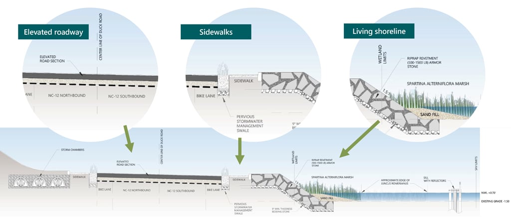
This was not merely a one-and-done solution but rather a dynamic and layered approach designed to adapt and thrive in the face of ongoing challenges. By embracing the principles of resiliency and incorporating diverse strategies, the Town of Duck is not only safeguarding its infrastructure but also fostering a more sustainable and vibrant community for generations to come.
Building Resilience with Strategic Funding
Another noteworthy achievement on this project is the impressive list of funding support it received for the construction phase. Navigating the grant funding process can be tricky, given the diverse requirements each grant entails, not to mention the dedication required for their preparation. Right around the time the improvements above were about to be put to bid in 2020, the Federal Emergency Management Agency (FEMA) announced its Building Resilient Infrastructure and Communities (BRIC) funding opportunity. We collaborated with the Town to develop a compelling application for this grant program, resulting in a successful award of $1.85 million. This process included developing an Environmental Assessment (EA) in accordance with the National Environmental Policy Act (NEPA) to perform an evaluation of the proposed action and alternatives. In addition to the BRIC grant, the project received funding from the National Fish & Wildlife Foundation, Dare County Tourism Board, Dare County Soil & Water Conservation, and an additional $1 million from the Department of Environmental Management upon project completion.
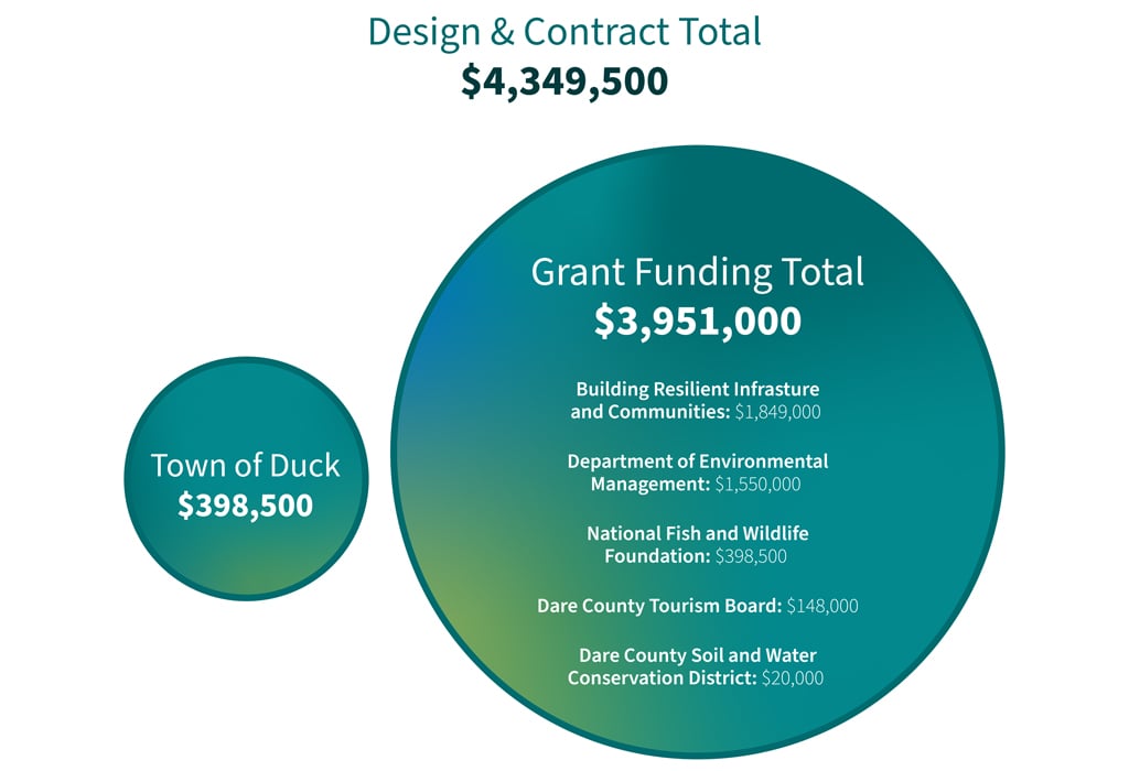
The Town of Duck Living Shoreline and Resiliency project received numerous funding support for the construction of the project, which lowered the cost for the Town to $398,500.
From utilizing nature-based solutions to incorporating pedestrian infrastructure to leveraging grant funding, the Town of Duck Living Shoreline and Resiliency project proves that meeting climate challenges requires innovative, comprehensive approaches. This project imparts the importance of exploring varied strategies to safeguard infrastructure and foster sustainable communities—blending seamlessly this knowledge and innovation with local understanding and community interest. With the Town’s population multiplying by 20 once summertime hits, I am more excited about how this project enhances the quality of life for visitors and residents. The Outer Banks, and the Town of Duck especially, are treasured destinations for many, and I am thankful to have played a small role in its preservation.
Learn more about Resiliency at VHB, or reach out to me for more information by emailing me or connecting on LinkedIn.


