With Florida experiencing an average of 89 tornadoes annually and frequently enduring hurricanes that cause widespread flooding and debris, accurate and rapid assessment of road conditions is crucial. In the wake of increasing storm events, Florida Department of Transportation (FDOT) District 3 employees have a powerful response tool developed by VHB at their disposal: a data-informed field survey app designed to streamline recovery efforts and enhance public safety throughout the state’s transportation system. The Detailed Damage Inspection Report (DDIR) tool’s real-time data capabilities not only increase the efficiency of on-ground crews but also improve coordination across departments, elevating effective response to Florida’s pervasive storm-related transportation challenges and expediting access to federal emergency relief funding.
DDIR’s are required for state eligibility to receive Federal Highway Administration (FHWA) Emergency Relief funding for highways, bridges, and roads damaged in natural disasters. The FDOT DDIR tool developed by VHB has both mobile and desktop applications to support field collection and administrative efficiencies. The mobile workflow uses a combination of global positioning systems (GPS) and geographic information systems (GIS) to allow reconnaissance of storm damage to begin immediately after the storm has passed and safe conditions return.
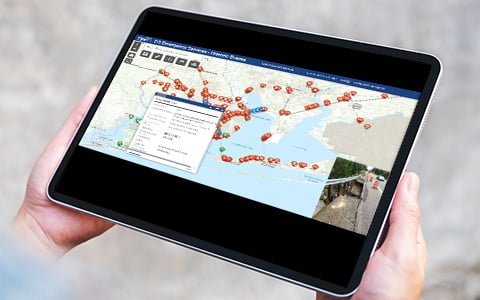
“The mobile app utilizes Esri ArcGIS Survey 123 to gather, analyze, and share data, including photos in real time,” said Keith Smith, VHB Technology Enablement Data Program Director. “The streamlined app elevates FDOT response teams to be the eyes and ears in the field that FDOT control room employees need to monitor storm events and make critical, quick decisions that keep roadways safe and in operation.”
Displaying the collected point data onto an interactive map and dashboard allows District staff to quickly understand the impacts of a storm and affected area. Additional layers distinguish federal aid roadways and asset tracking, where possible, to aide in recovery.
VHB team members configured the DDIR field survey and supported training and collection of the field information for a combination of both District staff working out of the office for field collection, and external stakeholder teams engaged in recovery efforts. The tool’s administrative efficiencies replace paper with digital records that all departments can immediately access and get repairs underway, sometimes even before field response teams return to the office.
“Data-informed technologies are at the forefront of VHB’s work with transportation clients like FDOT. This app is crucial for emergency response teams who must swiftly identify and address impeded roadways to mitigate hazards,” said Dave Mulholland, VHB Chief Technology Officer.
The flexibility of VHB’s workflow and responsiveness was showcased this past spring of 2024 when a severe thunderstorm system passed through the panhandle spawning tornadoes and causing damage across Florida’s capital city of Tallahassee. FDOT Central Office employees located in Tallahassee were directly impacted by storm damage and power outages. Within hours of the tornadoes touching down and while some FDOT staff were still recovering from the impacts, the VHB team was able to provide response support of the emergency repair efforts.
Learn more about how VHB is using technology to help clients with their most critical challenges.